

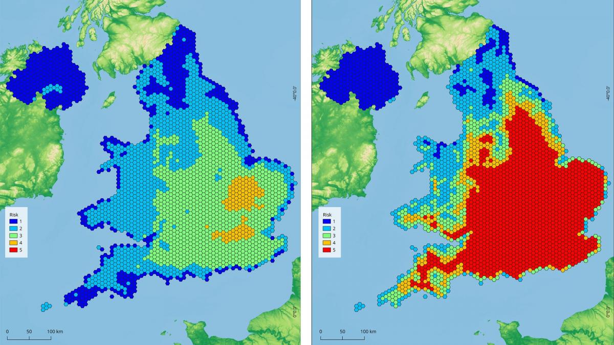
The National Trust has developed a map that illustrates the threat posed to some of Norfolk's most historic stately homes by climate change and what can be done to protect them.
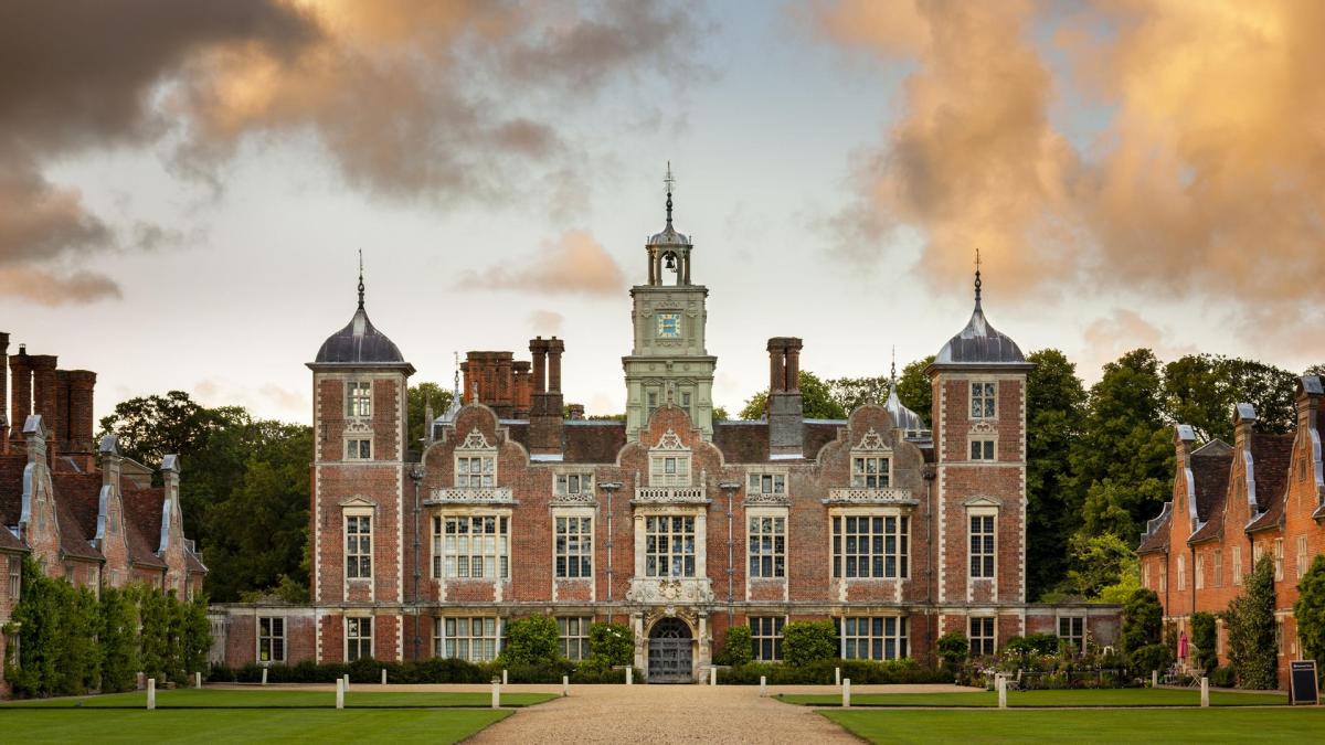
From Blickling Hall's library which contains first editions of some of Jane Austen's most famous works to the gardens of Felbrigg Hall, many of Norfolk's historic homes are already feeling the effects of global warming.

In a bid to help protect its sites from the worst of the impact of increasingly erratic weather and rising temperatures the National Trust has created a map that uses existing data on climate change-related events to understand how, at a local scale, sites may be at risk extreme heat and humidity, flooding, landslides, coastal erosion, soil heave or high winds now and in the future.
Working to a worst-case model of no intervention on emission levels, the map is intended to be used as a “flagging tool” to highlight potential hazards.

In Norfolk, work is already being carried out to safeguard the county's famous stately homes.

At Blickling Hall, which is highly exposed to wind-driven rain, work is being done to ensure the 17th-century building's facade is watertight to protect its 12,500 volume library, which is the largest in the NT's care.
Deathwatch beetle-infested timbers have been removed and replaced to improve the building’s integrity and help protect the collection from future heavy rainfall.

While a few miles away at Felbrigg Hall, the home's exotic gardens have thrived during increasingly hot and dry summers and are expected to continue to do so, in part to the head gardener's decision to introduce plants native to the Mediterranean, South Africa, Australia and the deserts of Mexico.
Harry Bowell, National Trust director for land and nature, said: “This map is a game-changer in how we face the threat climate change poses to the places we care for.
“While the data draws on a worst-case scenario, the map paints a stark picture of what we have to prepare for. But by acting now, and working with nature, we can adapt to many of these risks."


Comments: Our rules
We want our comments to be a lively and valuable part of our community - a place where readers can debate and engage with the most important local issues. The ability to comment on our stories is a privilege, not a right, however, and that privilege may be withdrawn if it is abused or misused.
Please report any comments that break our rules.
Read the rules here